| Home / Environment / Photo News | Tools: Save | Print | E-mail | Most Read |
| Tibet Experiences Third Warm Winter in Seven Years |
| Adjust font size: |
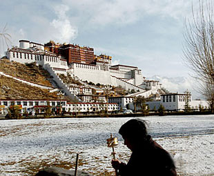
"The average temperature in some parts of the The temperature in the regional capital of Ma said most parts of The China Meteorological Administration's definition of a warm winter is a temperature rise of 0.5 degrees above the historical average. Meanwhile, most parts of The warm and arid climate were to blame for several forest fires in Qamdo and Nyingchi prefectures and were likely to increase the risks of plant diseases and insect pests in the summer, Ma said. The second warmest winter was reported in 2000-2001, with a 1.6-degree temperature rise. Global warming has led to the acceleration of glacial melt in the Qinghai-Tibet Plateau, dubbed the "Roof of the World." The plateau, regarded as a barometer for the world's climatic conditions, has seen its glaciers melt at an annual average rate of 131.4 square kilometers over the past three decades. The shrinking of glaciers, widespread drought and the decrease in grassland are threatening the plateau, geologists said. The Qinghai-Tibet Plateau is the cradle of three main Chinese rivers, the Yangtze, Yellow and Lancang rivers. Most of the Chinese civilization emerged along the valleys of the Yangtze and Yellow rivers. (Xinhua News Agency April 24, 2007) |
| Tools: Save | Print | E-mail | Most Read |
 |
| Related Stories |
|
||||