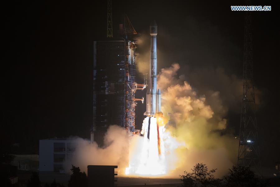
Launch of twin Beidou navigation satellites pushes regional integration agenda further
- By Rachana Gupta
 0 Comment(s)
 Print
Print E-mail China.org.cn, November 30, 2018

November 19, 2018 marked an important date for the Beidou navigation satellite system (BDS) when twin Beidou-3 navigation satellites were launched with the help of the Long March-3B carrier rocket from Xichang Satellite Launch Center in Sichuan Province. The satellites -- upon completion of the initial tests and evaluations -- will work together with the already active 17 Beidou-3 satellites in orbit and will extend their coverage to Belt and Road (B&R) countries.
Development of Beidou in China
Notably, the BDS project -- albeit first conceived in the 80s -- was officially launched in 1994. Subsequently, the first stage of the Beidou system, which means the Big Dipper in Chinese, became functional in 2000. The project has been striving forward ever since. Currently, China is upgrading its previous generation of Beidou-2 to Beidou-3. By 2020, upon its completion, BDS will have a constellation of 35 satellites to provide global coverage. Beidou presently is being used for both military and civil purposes. For instance, BDS related products have widespread use in areas such as communication, surveying, weather monitoring, mapping, disaster mitigation, and emergency search and rescue. BDS, once fully deployed, will be the fourth as well as the most accurate global satellite navigation system among other existing systems including the USA's GPS, Russia's GLONASS and the European Union's Galileo.
Additionally, the application of Global Navigation Satellite Systems (GNSS) -- comprising both products and services -- has recently acquired an important role with the increasing number of smart cities, smart agriculture applications, wearables, IoT devices, drones, high-speed trains, and autonomous vehicles, etc. According to the GNSS market report in 2017, the Asia-Pacific region will account for the largest regional GNSS market with an increase in the number of installed bases from 1.9 billion in 2015 to 4.3 billion by 2025 and a corresponding revenue increase from €32.7 billion in 2015 to €96.8 billion by 2025. Further, the report stated that nearly 80 percent of the GNSS installed bases is comprised of smartphones. Thus, with the continual rise in the number of smartphones and other AI-based smart devices, it is expected that the market for BDS equipped devices will continue to soar in the years to come.
Furthermore, BDS will also be compatible with the U.S.-owned Global Positioning System (GPS) and users of either system could use the other at no extra cost. Most new smartphones from Chinese manufacturers such as Huawei, Xiaomi and OnePlus already support Beidou. Now, signals will be more reliable as devices are given access to more satellites and as a result, location services will be more precise too. Additionally, the system has a positioning accuracy of up to 2.5m, which is ten times more accurate than the highest level of GPS. This could be further improved in the future to the centimeter level.
Importance of the launch
Moving forward, the launch of the twin Beidou-3 satellites is important because by the end of this year, the satellites will help the system provide its services to all B&R countries, thus playing a significant role in the Space Silk Road project. Notably, the "Space Silk Road" concept was coined for the first time in 2014 by the International Alliance of Satellite Application Services (ASAS) with the intended goal to boost the capabilities of the participating countries in space technologies including satellites, launch services, ground infrastructure and development of related industries and service providers. This will provide impetus to China's strategy of "going global" and push its regional integration agenda further.
Beidou-3 is an upgraded version of the previously launched versions, Beidou-1 and Beidou-2. The Beidou-1 system was limited to providing navigation, positioning, timing, and short-messaging services to the whole of China and its neighboring nations. Later, the upgraded version, Beidou-2 system after its launch in 2012, extended services to the entire Asia-Pacific region. Beidou-3 system, upon completion, is the most advanced system and is expected to provide global coverage by 2020.
Currently, the Beidou system for navigation is installed in approximately 6.3 million public and private vehicles in China, including buses, cars and trucks, which are further expected to rise by 10 percent year-on-year. Recently, a remote-control water supply system has also been developed using Beidou short-messaging services. The system, which for the first time was tested in June 2018, assists herdsmen in controlling the water usage of their livestock without being physically present on-site. Herdsman can directly operate the devices installed in the farm without the influence of mobile networks, by sending short messages. China also plans to introduce this remote water supply system to B&R countries.
Additionally, as per Global Times, Pang Zhihao, a Beijing-based aerospace expert mentioned that BDS can serve the maritime communication needs of B&R countries by providing vessels with shortcut routes, free of dangerous weather and sailing conditions. The system can also serve infrastructure construction analysis such as building tunnels with accurate measurements. Thus, with this new step forward towards the completion of the Beidou-3 system, China is also making a stride in its goal to create new opportunities and win-win cooperation based on mutual trust for B&R countries.
Rachana Gupta is a China Focus columnist, an expert author of Ezine Articles and an active blogger and poetry writer.
Opinion articles reflect the views of their authors only, not necessarily those of China.org.cn.


Go to Forum >>0 Comment(s)