China's disaster relief authority has asked for domestic and international help in getting quake-related data collected by satellites to aid Sichuan relief operations.
The State Disaster Relief Commission (SDRC), a member of the International Charter "Space and Major Disaster", asked on Tuesday for satellite data about Monday's quake. The request went out to charter members - the European Space Agency, The United States Geological Survey, the Canadian Space Agency, the Japan Aerospace Exploration Agency, and the Indian Space Research Organisation. The first to respond was the Japanese side, which provided satellite images of the area hit by the earthquake of 7.8 on the Richter scale.

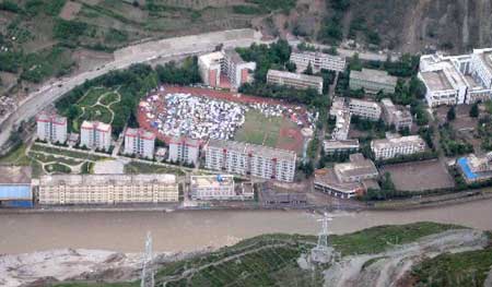
Pictures taken from a helicopter Wednesday shows the view of Wenchuan County, the epicenter of Monday's earthquake that jolted southwest China's Sichuan Province.
They are the first large-scale images from space of the quake that has so far claimed at least 12,000 lives.
China joined the International Charter "Space and Major Disaster" on May 25, 2007.
Using members satellites, the charter provides a unified system of space data acquisition and delivery to those affected by disasters to help with relief efforts.
The SDRC has also asked for data from commercial high-definition satellites used by the country's domestic operators.


(Xinhua News Agency May 14, 2008)