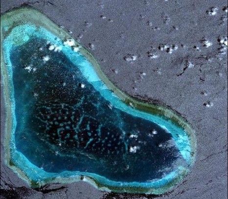
China satellite to monitor Diaoyu, Huangyan Islands
- By Wang Mengru
 0 Comment(s)
 Print
Print E-mail China.org.cn, September 3, 2012

The ocean dynamic monitoring management system has incorporated the Huangyan, Diaoyu and Xisha Islands, greatly increasing the intelligent monitor capabilities of offshore marine areas, according to China’s State Oceanic Administration.
Images of the Huangyan, Diaoyu and Xisha Islands have already been processed and added to the system. The image solution is 0.5 meters, and covering a total area of more than 500 square kilometers.
The national ocean dynamic monitoring management system can utilize stereo and motion monitoring of offshore marine areas by using satellite remote sensing, aerial remote sensing and ground remote sensing. It can provide decision support and information services for governments at all levels, oceanic departments and the public.
The national ocean dynamic monitoring management system was built in 2006 and put into operation in 2009.
"The system can observe the changes of water temperature, ocean color, ocean area, airflow field and waves," said Tang Danling, a researcher at the South China Sea Institute of Oceanology at the Chinese Academy of Sciences. "It can promote ocean environmental protection."


Go to Forum >>0 Comment(s)