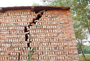
An earthquake measuring 5.6 degrees on the Richter scale jolted a county in northwest China's Qinghai Province at 5:53 PM (Beijing Time) Wednesday, according to the China Seismological Bureau.
The epicenter was located in a sparesly populated pasturing area on the Qinghai-Tibet Plateau at 33.0 degrees north latitude and 96.3 degrees east longitude, about 70 kilometers south of the county seat of Yushu.
The area was hit by another earthquake measuring 5.0 degrees on the Richter scale on Tuesday.
No casualties from both the quakes have been reported, according to the bureau.
With a population of 240,100, Yushu County is located in the southwest of Qinghai. It is under the administration of the Yushu Tibetan Autonomous Prefecture, which covers an area of 198,000 square kilometers or 27.5 percent of the province's total.
The vast grasslands and snow mountains in the prefecture jointly form the headwaters of three major rivers of China: the Yangtze River, the Yellow River and the Lancang River.
(Xinhua News Agency July 20, 2006)

