People of different ethnic minorities dressing in their distinctive costumes were common along the way. Zhu told us that they were Lisu, Nu and Yi people. After a while, I gave up trying to learn how to distinguish them by their clothes.
Overhead cables are still used by the local people to cross the river and it was thrilling to watch several local villagers, including an old woman, speeding across the river like that.
When we arrived at Gongshan county at 9 am, the town, which spread on both banks of the river, was still half clouded in mist. From there, we headed to Bingzhongluo along a newly paved road, which was halfway up the Gaoligong Mountains.
Half an hour later, we passed the entrance of Bingzhongluo National Park, a checkpoint on the road where outsiders must pay 20 yuan ($2.90) for admission.
Soon we arrived at the first lookout, over the first hairpin bend of the river. On a small tableland nestles a hamlet of the Nu people, whose stilted houses roofed with slices of black rock are shaded by woods. Plots of corn and wheat had already been harvested and villagers were busy ridging the land with their buffaloes. Dwarfed by cliffs of the Biluo Snow Mountains, the isolated land looked so peaceful.
Then came a lookout offering an awe-inspiring panoramic view of Bingzhongluo, which made one realize why this largest tableland in the Nujiang River Gorge has long been considered a "Land of Peach Blossoms", a fictitious land of peace unspoiled by the outside world.
On one side, the Gaoligong Mountains with their snow-capped summits separate Bingzhongluo from Tibet, while on the other, the river and Biluo Snow Mountains separate it from northwestern Yunnan.
While modern concrete structures are concentrated around the town, houses and fields belonging to the Lisu, Yi, Nu, Dulong, Bai, Naxi and Tibetan people are spread out on both sides of the river.
The good environment and climate have attracted many ethnic groups to the area. "So you also find a few different religions at Bingzhongluo," Zhu said.
At the one-street town, we found a white stupa built by the local Tibetans. Along the newly paved road down to the river, we saw a white church at Chongding village. It was built by a French missionary 100 years ago, though the present structure is a replica of the original.
The 18-km paved road, winding along the northern bank of the river, passes a few more villages, a scenic site called Stone Gate Pass (Shi Menguan) - the narrowest site of the Nujiang River where sheer cliffs close in around the river and an endemic plum tree grow tenaciously on the cliff walls, and ends at a bridge.
Crossing the bridge, the road divides in two. One road is the remains of an old horse track, or "Tea Horse Caravan Route", to Lhasa. Another is the new road to southeastern Tibet, which is still under construction. "Once the road opens in the next year, Bingzhongluo might regain its importance as a gateway to Tibet," Zhu said.
Hiking is the best way to admire the area's beauty but with very limited time, we had to turn back.
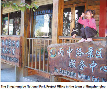
At the town of Bingzhongluo, I found the project office of Bingzhongluo National Park. But it seemed that the office wasn't functioning yet, as no one was working inside.
Later, Lan Huiming, director of Gongshan tourism administration, explained: "It is because the Yunnan provincial government has not approved the project yet."
"The launch of the project relies on whether or how the dams will be built on the river, though according to the present plan, no dam will be built near Bingzhongluo," he said.
Although the TNC has helped the park complete a tourist interpretative system at Bingzhongluo and the local government has issued a regulation restricting construction of more concrete buildings at Bingzhongluo, "we can only prepare and wait at this moment," he said.
(China Daily November 11, 2008)