|
|
|
|
Main Mountain Ranges |
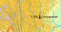
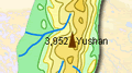
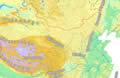 Numerous
lofty mountains form many mountain systems, which serve as the framework
of China's topography. Well-known mountain ranges in China are the Himalayas,
the Kunlunshan Mountains, the Tianshan Mountains, the Qinling Mountains,
the Greater Hinggan Mountains, the Taihangshan Mountains, the Qilianshan
Mountains and the Hengduanshan Mountains. Numerous
lofty mountains form many mountain systems, which serve as the framework
of China's topography. Well-known mountain ranges in China are the Himalayas,
the Kunlunshan Mountains, the Tianshan Mountains, the Qinling Mountains,
the Greater Hinggan Mountains, the Taihangshan Mountains, the Qilianshan
Mountains and the Hengduanshan Mountains.
|
|
Himalayan Mountain Range |
|
|
|
Kunlunshan Mountain Range |
|
|
|
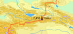
Tianshan Mountain Range |
|
|
|
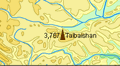
Tanggula Mountain Range |
|
|
|
Qinling Mountain Range |
|
|
|
Greater Hinggan Mountain Range |
|
|
|
Taihangshan Mountain Range |
|
|
|
Qilianshan Mountain Range |
|
|
|
Hengduanshan Mountain Range |
|
|
|
Taiwan Mountain Range |
|
|